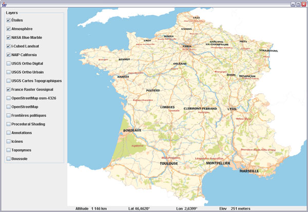
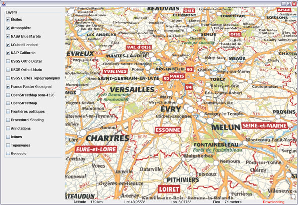
Geosignal French maps in WWJ
Toulouse based Geosignal has made freely available for more than a year a number of interesting layers on their WMS server. Here is a layer class for WorldWind Java that will bring together eight levels of details from the RASTER maps serie.

Download GeosignalRasterWMSLayer.java, remove the .txt extension and add to the SDK layers.Earth package.

The layer covers continental France and Corsica. The finest levels include street maps for most urban areas.

Download GeosignalRasterWMSLayer.java, remove the .txt extension and add to the SDK layers.Earth package.
The layer covers continental France and Corsica. The finest levels include street maps for most urban areas.


4 comments:
That could be great news for me. Just three weeks before JavaOne I've got some doubts about what kind of maps to show in blueMarine because of licensing issues. Is it GeoSignal open to use without any issue? Thanks.
Sorry, i have no idea to what extent you can use those layers. I sent Geosignal a message via their contact page.
as soon as you don't use our WMS server for commercial products, there is no limitation.
Regards
C. Chantraine
Monsieur C. Chantraine,
thank you very much. It's great that GeoSignal pays this attention to the world of non-commercial software and other geo-companies should just learn from you.
Post a Comment