First World Wind Java Applet and integration
While i was deep into details of the WWJ code, some very interesting things happened from several european users : the first WWJ applet from Toulouse, France and a very nice integration into blueMarine, an open source photo workflow application from Milano, Italy (not very far apart...).
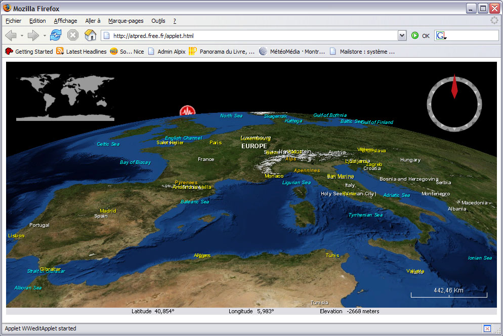
First World Wind Java Applet
Stéphane Maldini (aka pred) and Nicolas Castel (aka vash), two WWJ forum contributors, have made steady progress at bringing WWJ into a browser and recently posted a link to this WWJ applet page.

Beware that it can take a little while to load (probably 5 to 10 MB) and it may ask you some unexpected questions about your Java configuration. I'm not sure it flowlessly works across platforms yet.
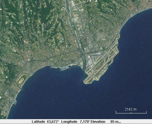
This demo includes a GeoRSS stream reader that displays recent earthquakes icons with actives links to the appropriate web pages. According to pred, this applet is part of an online GeoRSS editor project... More screenshots on Chad's The Earth Is Square blog.
WWJ integration into blueMarine
Since the may release of WWJ, Fabrizio Giudici, one of the author of blueMarine, has been very active at embedding it into his application to offer a 3D perspective on geo-referenced photo sessions.

The result is quite beautiful. Well done Fabrizio!
First World Wind Java Applet
Stéphane Maldini (aka pred) and Nicolas Castel (aka vash), two WWJ forum contributors, have made steady progress at bringing WWJ into a browser and recently posted a link to this WWJ applet page.
Beware that it can take a little while to load (probably 5 to 10 MB) and it may ask you some unexpected questions about your Java configuration. I'm not sure it flowlessly works across platforms yet.
This demo includes a GeoRSS stream reader that displays recent earthquakes icons with actives links to the appropriate web pages. According to pred, this applet is part of an online GeoRSS editor project... More screenshots on Chad's The Earth Is Square blog.
WWJ integration into blueMarine
Since the may release of WWJ, Fabrizio Giudici, one of the author of blueMarine, has been very active at embedding it into his application to offer a 3D perspective on geo-referenced photo sessions.
The result is quite beautiful. Well done Fabrizio!


