Saturday, December 15, 2007

Blue Marble Twelve Month for WWJ

The imagery is already there for WorldWind .Net, so it is just a matter of configuring a layer for each of the twelve Blue Marble Next Generation datasets for the year 2004.

Blue Marble twelve month for WorldWind Java
Download BMNG2004Layer and BMNGTwelveMonth example application. The layer goes in worldwind.layers.Earth, and the example in ...examples.

None of the twelve layers have a 'base' image yet (except may 2004), so you will have to wait for the level zero tiles to download the first time you switch month.

A WMS version of those datasets should be available a some point.

Thursday, December 13, 2007

Full Mars And Moon Globes for WWJ

Here they are, the Moon and Mars with elevations and the full layer sets from the .Net version.

WWJ Mars THEMIS ColorMars THEMIS Color layer

WWJ Moon Clementine 30Moon Clementine 30

Download WWJ_Moon_And_Mars.zip (15k) and add to your WorldWind Java SDK source tree.

The package includes two example applications that put together the two globes with the appropriate layers.

Be patient at first run: these globes do not have a 'base' image layer that ensures you see something even with an empty cache. So the first time you will have to wait for the level zero tiles to get through before you have a planet to spin.

The elevation data comes from the same servers as the .Net version but in zipped files. This service has never been used and has an empty cache right now, so the first users will have to wait a bit longer to see some alien mountains.

Tuesday, December 11, 2007

WWJ Look Around View Example

WWJ View Look Around example
Here is a view control panel example that simulates a 'first person' view with the default orbit view.

Download the ViewLookAround.java example - remove the .txt extension and add it to the worldwind.examples package.

Although this is far from a first person view implementation that would let you walk or fly around, this simple example allows you to 'look around', as if you where suspended in the air at a fixed position.

Sunday, December 9, 2007

WWJ Layers That Shall Not Be Named

Vladimir Silva who brought us the World Wind Eclipse RCP Geobrowser just posted a new contribution on the WWJ forum. Something that many where hoping for - without saying it too loud... someone said applet?

Check this forum thread, and the reference material.

Wednesday, December 5, 2007

WorldWind Java SDK 0.4.1 offline mode fix

A bug fix release has been posted late today. Here are links to the WWJ SDK 0.4.1 (Zip 6.5M) and the Java Web Start demo 0.4.1.

From the forum post:

"Fixed NetworkStatus bug causing freeze for some, added an off-line attribute to the WorldWind class to elect not to use the network, added a show-network-status attribute to StatusBar".


And from a post related to offline mode issues:
"I've also added an off-line mode attribute to WorldWind for apps that never want to contact the net. Just invoke WorldWind.setOfflineMode(true)."

I updated my previous post about 0.4 - was it yesterday?

Tuesday, December 4, 2007

WorldWind Java SDK 0.4 is out

As previously hinted a new code update has been posted today by the WWJ team. Here are links to the WWJ SDK 0.4.1 (Zip 6.5M) and the Java Web Start demo 0.4.1.

WorldWind Java SDK 0.4.0
What has changed since 0.3 - October 10, 2007:

Annotations are the main new feature - you have already seen a couple screenshots here. I will come back to them in future posts.

As usual, many bug fixes and corrections have taken place - some in response to the forum comments and requests: the shutdown process has been revisited, the input handler now allows the application to use and consume mouse events before they get to it, layer opacity support has been improved - although it is not yet what you would expect. WMS capability parsing has been made faster too and network operations should generally behave better when offline.

Flat worlds have been moved to the main source folder so you can have a glimpse of it - however it is not yet ready for prime time as you will quickly find out.

The image tiles processing order has been revisited and will now load lower resolution levels before loading the needed one. This behavior ensures that a layer stays 'consistent' when zooming out - tiles are not missing.

New level set constructors allow to create custom tiled image layers - see BMNGLandsatCombined example.

You will notice the overall WorldWind SDK package is lighter - 6.5M vs 13M. The Blue Marble level zero tiles have been removed and replaced with the BMNGOneImage 'base' layer. Worldwind.jar is now 1.6M vs 5M in the previous version.

December 5 update: version 0.4.1 has been posted in response to problems with offline operations: "fixed NetworkStatus bug causing freeze for some, added an off-line attribute to the WorldWind class to elect not to use the network, added a show-network-status attribute to StatusBar". Above links have been updated.

Check this post on the WWJ forum for details of the version readme.txt and follow up comments. Also check WorldWind Java SDK home pages at NASA Learning Technologies and WorldWind Central.

Friday, November 30, 2007

WorldWind Java Annotations Preview

Annotations are ready to roll and will be in the next WWJ SDK update 0.3.x or 0.4 - which should be ready 'soon'... Here are a couple screenshots showing different variants from the included example application.


Annotations are essentially text labels with a lot of style attributes. They will come in two flavors: globe annotations which are associated with a position on the planet, and screen annotations which are at a fixed position in the viewport.

In the above view all you see are annotations - from the simple 'Egypt', 'Libya' or arabic for 'Sahara desert' labels to the full blown 'billboards' or 'bubbles' with textured backgrounds and moderately wealthy text.

As you can see annotations come with a multi line text renderer and 'wrapper' with minimal html support, text picking and hyperlinks. The text about the Tibesti mountains is a cut-and-paste of a paragraph straight from a Wikipedia page source.


The example application will offer you no less than 39 controls to experiment with all the annotation attributes combinations. Text font, size, style and alignment, insets 'margin', background color and texture repeat options, dimensions, scaling, opacity, offset from position... Overall it should cover quite a range of applications from simple labels to moderately sophisticated 'popup balloons'.

In any case, if the SDK basic implementation is not enough, it is very easy to subclass annotations and override the drawing process to add your own code in place or on top of it. The example does also contain several override code bits - you'll have to read the source to find them.

This is just an 'avant goût' to get you salivating a bit. I will come back on the subject for more detailed explorations of this new feature of the SDK - like shared attribute sets and cascading defaults...

Monday, November 26, 2007

Mars and Moon layers for WWJ

Someone just asked about Mars in the WorldWind Java forum and this reminded me the imagery is out there for the .Net version of WW, begging to be streamed into WWJ.


Mars MOC Colorized 256 layer


Moon Clementine 40xx color layer

Here are Mars MOCColorizedLayer.java and Moon Clementine40Layer.java - they are supposed to go in worldwind.layers.Mars and Moon respectively. December 13 update: get the two full globes here.

This of course is just a preview of the two bodies - over the Earth surface. The elevation data is out there too, but needs to be compressed differently for WWJ, and that is not ready yet, i believe. Eventually the Moon and Mars will have their own globes, elevation models and layer sets.

Saturday, November 24, 2007

WWJ Bug Exhibition

Sometime things go wrong. In most occurrence it doesn't produce anything more than irritation, but on rare occasions it can also lead to quite unexpected or intriguing results. Here are a few screenshots captured in such moments:


The 'globe back flip' made a fugitive appearance recently. New Zealand was on top of the world at last.


What came to be known as the Butterfly World emerged spontaneously from a wrong modification of the sinusoidal projection in flat worlds... i was expecting more of an oval shape, and there it came out. I took the screenshot and corrected the code. We will never know what was the formula. Chaos and butterflies, what a cliché.


The bold garbled text bubble briefly showed up during annotations development, while challenging JOGL text renderer with lots of larger fonts. What powerful message is hidden in this unknown dialect?

I cant help but feel there is something far reaching in the symbol. At a private showing in New York, someone fainted and a guest got so agitated he had to be helped out. "The big void in the middle of the first line is very unsettling i admit" declared the embarrassed host.

Sunday, November 11, 2007

WMS Layers on iPod Touch

Almost two weeks since i got the IPT and so little time to hack into it... I still havent managed to install the iPhone applications but i got it 'jailbreaked' and have a Finder now with a couple additional icons. However it will probably not last long with the coming firmware updates...

It is quite exciting to see that the little tablet is a 400Mz OS X platform. There are already many sites dedicated to using the touch or the phone as an 'open', mobile, computing device and many applications are coming.

Blue Marble Next Generation on iPod Touch
Actually, the easiest way to make an application for these device is to use html and javascript with Mobile Safari. These are so called 'web applications'.

So back to Notepad and some good old school javascript, i put together a very simple mobile WMS browser (updated november 16).

This is not World Wind but at least you can browse a couple WMS layers i grabbed from the WMSLayerManager example in the WW Java SDK: Blue Marble Next Generation (june 2004), Blue Marble 'classic', Landsat7 I3, Global mosaic 15m visual, Terra/Aqua daily shots and a few others (including France BRGM geology and USGS layers).

Have a look at the source - its all contained in one page and it is very easy to add more layers. Feel free to copy, edit, reuse and abuse ;)

Tapping (or clicking) on the edges or corners of the tile will have you move sideways or in diagonal. Tapping inside the image will zoom on the corresponding latitude and longitude.

Some controls at the bottom let you zoom out, goto a specified latitude and longitude and select different layers. Still a bit crude, but usable... and you can put (and share) bookmarks anytime.

The page has to be hosted somewhere though. I wonder if it could simply be transfered in the IPT and opened locally with Mobile Safari. Probably easy to do if you know a bit OS X or Linux...

Thursday, November 1, 2007

Stereo anaglyph WorldWind Java applet online

Andrea Caporin from GIS Solution, Italy, upgraded his WWJ applet demo to 0.3 and had the good idea to include the new anaglyph scene controller and controls. The italian Alps are gorgeous in stereo...


As far as i know this is the only stereo virtual globe you can find online...

Tuesday, October 30, 2007

WWJ on iPod Touch: when will it be ?

OK, i admit, i bought one this afternoon, and i cannot resist to show off a mock up of WorldWind Java on the iPod Touch beautiful screen:


It seems inevitable that Java will run one day on this device, considering the constant efforts from Sun to provide virtual machines and API for the increasingly powerful mobile gadgets we have these days. Now to get Open GL and JOGL decently running will be another challenge...

Thursday, October 25, 2007

A couple tricks to speed up WWJ

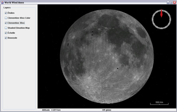
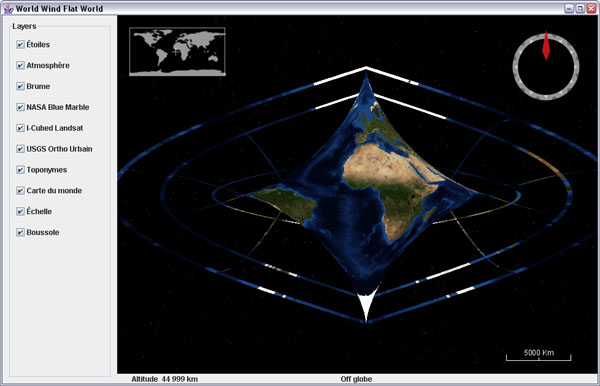
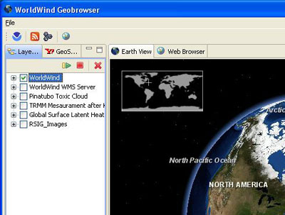
There are many applications where you only need the globe without elevation details - think satellite tracking or global imagery viewing, and others where you are ready to give up a bit of relief geometry details for a faster interaction.

If that is the case, there are two ways you can help yourself.

Using a full sphere SurfaceImage

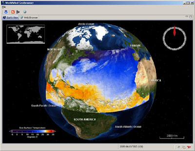
One feature that has been incorporated a few month ago allows you to use a single image and paint it over the globe inside a sector or over the full sphere. This allows you to trade the BMNG tiled image layer for a single image BMNG layer - that is also included in the worldwind.jar, which results in a faster startup time and 'lighter' globe to interact with.
// From examples.applet.WWJApplet
// Add a BMNG base layer to the model layer
// list, before the Blue Marble
insertBeforeLayerName(this.wwd,
        new BMNGOneImage(), "Blue Marble");

Of course, if you zoom onto that layer, you will not get better details as with the tiled version... unless you also have it on top. The wwj applet example uses that one-image layer.

Hacking the tesselator

If you have a look at the actual default configuration EllipsoidRectangularTessellator in globe, you will notice right at the start a static constant named DEFAULT_DENSITY with the value 24. This class is responsible for building the terrain geometry using regular lat/lon aligned (rectangular) tiles each segmented like a check board in rows and columns. With the default density, there are 24 rows and columns per tiles.
// From EllipsoidRectangularTessellator
private static final int DEFAULT_DENSITY = 3; // 24;

The density determines how fine - and accurate, the terrain relief will look. However, you would be surprised to see that with a density value as low as 3 the terrain still displays very decent mountains and relief... and WWJ gets much more responsive.

Update march 22, 2008: After further scrutiny, it appears i was wrong about what i though the density value would control. When decreasing this value, it does indeed reduce the number of rows and columns per tile, but then the tiles are smaller - and there are more of them, which results in many more 'skirts' or tile sides to render, and doesn't change the geometry level of detail...

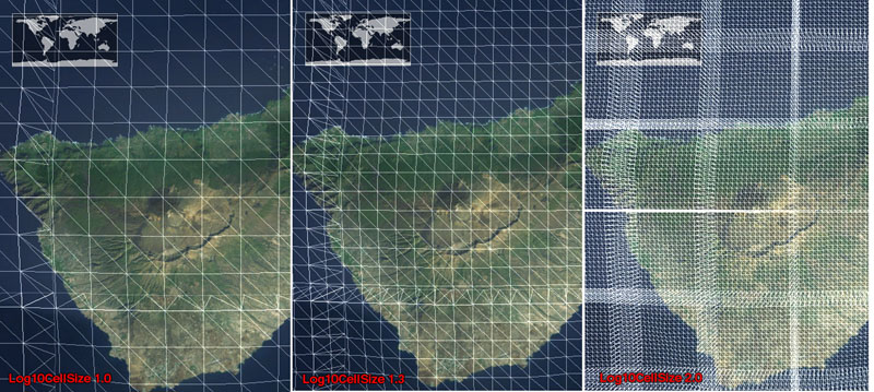
What does matter is another value named DEFAULT_LOG10_RESOLUTION_TARGET and located in the upper portion (but not the beginning) of the globe.RectangularTesselator.

// From globes.RectangularTesselator.java
private static final double 
      DEFAULT_LOG10_RESOLUTION_TARGET = 1.3;


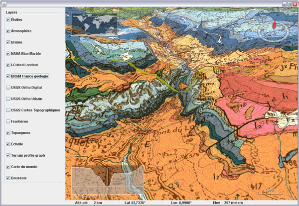
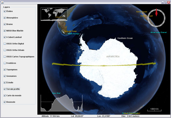
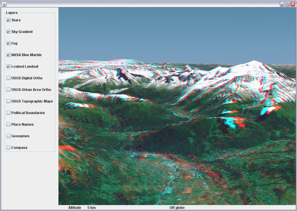
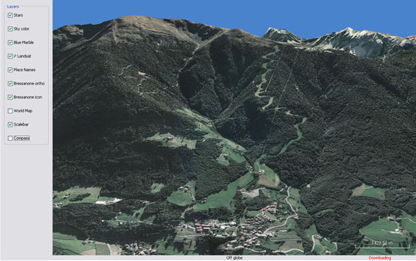
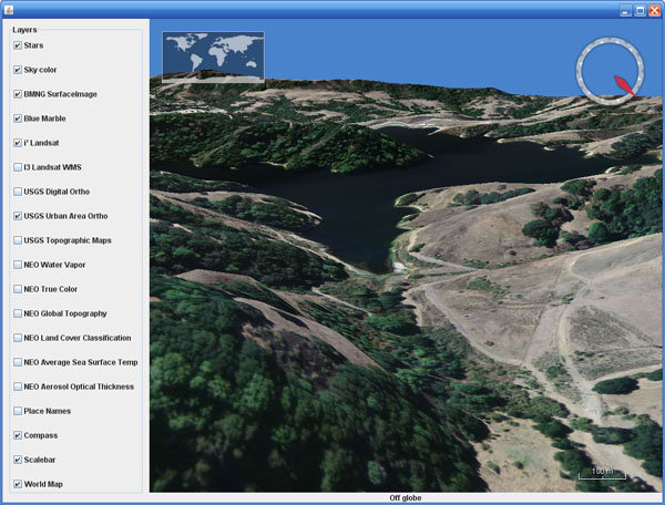
This one will indeed control the mesh 'density' - see screenshot below.

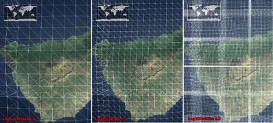
Log10 resolution: 1.0 (left), default 1.3 (center) and 2.0 (right)

There is no public interface yet to access and change the tessellator density (or log10 resolution) setting(s) - i'll push for one to be implemented at some point. So all you can do for now is either edit the SDK source or clone the tessellator in your own package, change the setting and refer to it in the WWJ config file worldwind.properties.

Sunday, October 21, 2007

Flat worlds and annotations coming to WWJ

Here is a preview of coming features for WWJ 0.3.x...

Dragging shapes example on 'plate carrée' world

Flat worlds are still in the experimental stage but should ultimately allow to have both a 'cartographic' flat global view of the globe and 3D terrain. Various projections of the world should also become available. Quite fun and interesting.

Annotation tests

Comic books bubble annotations are on their way too. They will come with a simple general purpose multi-line text renderer and wrapper some have been asking for ;)

Thursday, October 18, 2007

World Wind Eclipse RCP Geobrowser

WorldWind Java SDK applications are getting more and more interesting. Using the Eclipse platform, Vladimir Silva created worldwindrcp a 'geoweb browser' with full support for WMS 1.1.x and 1.3.x, KML ground overlays, screen overlays, and placemarks. It also supports animated ground overlays to visualize events over time. Nice work!


This is starting to look like the WorldWind .Net version...

The source code includes two eclipse projects: the World Wind RCP itself: org.eclipse.plugin.WorldWind/ and a set of WW contribution layers (Animated time loops, KML/WMS support etc): WWContrib-025/

See this WWJ forum thread about worldwindrcp.

Wednesday, October 10, 2007

World Wind Java 0.3 is out

It has been five month since WWJ 0.2 was released at the Java One conference last may. A lot of work has been done since by Tom Gaskins's team. Several code updates have been posted on the forum, so you may already have a good idea of what to expect.... so here comes the new and enhanced World Wind Java SDK 0.3 (.zip 13M) and Java Web Start Demo.

Example application template - globe


San Francisco - USGS Urban Ortho layer

Here is an unsorted list of changes i can think of:

Since 0.2.5

  • Polylines have had a major update. They can now gently follow the underlying terrain, avoiding intersections, and should become a viable alternative to SurfacePolylines. Some optimization is still needed though.
  • Stereo anaglyph capability has been added with a new AnaglyphSceneController and a corresponding example application.
  • The SkyGradientLayer has been incorporated and nicely teams up with the FogLayer to provide some atmospheric effects to the globe.
  • An interactive terrain profile tool has been added with a corresponding example.

Before 0.2.5

  • There was a Point class in 0.2.0 which has been replaced with Vec4. Most Point methods are available in Vec4, but with a '3' at the end of the name - eg: getLength3().
  • Some major reorganization has taken place in the packages structure with the addition of many - more categorized, sub-folders.
  • An example package has been added. It contains an application template with some basic components and a growing list of simple applications, each showing a particular feature of the SDK.
  • Applet templates, one using javascript interactions, have been added with appropriate deployment notes in the examples.
  • SurfaceShapes quality and diversity have been improved - see Shapes example.
  • Mouse dragging support of objects has been added - see DraggingShapes example.
  • There has been major enhancements to the OrbitView with, among other things, the addition of ViewStateIterators, Animators and Interpolators. Click on the world map to see it in action or have a look at the WWJApplet javascript API.
  • Memory management and garbage collection have been greatly improved, reducing significantly the memory footprint.
  • Tools to access WMS servers have been added - see WMSLayerManager example.
  • Single image layers have been incorporated - useful for applets faster load-and-start. See StartupImage example and BMNGOneImage layer.
  • Stars, world map, scale bar, fog and sky color layers have been incorporated.
  • Support for runtime statistics has been added - see RuntimeStatistics example.
  • A Worldwind.shutdown method has been added
  • Support of tabbed panes and other potentially tricky UI configurations has been improved - see UsageInTabbedPane example.
  • Ground and air tracks support and rendering has been added - see PipeTracks example.
  • New USGS and Earth Observatory layers have been added.
  • Spherical and ellipsoidal triangle methods have been added to LatLon and Position classes.

There are surely many other improvements and bug fixes i'm forgetting here...

Check this World Wind Java forum thread for the release readme.txt and follow up comments. Also: WorldWind Java home page at NASA Learning Technologies and World Wind Central.

More screenshots:

Tracks and pipes example

Polylines following terrain - Shapes example

Tracks example

WMS Layer Manager example

Terrain profiler example

Anaglyph stereo example

Atmosphere entry over New Zeland

Thursday, October 4, 2007

French geology layer for WWJ

Here is a WMS layer to get access to the french BRGM geology maps in WWJ.


Download BRGMGeologyLayer.java and add it to the worldwind.layers.earth package, after removing the .txt extension. In BasicDemo add the layer on top of I3 Landsat, like the USGS layers. It will start to show tiles under 100km altitude.

This layer was already accessible through the WWXMLLayer code i posted last may, but some major refactoring have occured inside the SDK since then and i havent migrated the code yet.

Tuesday, October 2, 2007

Real time terrain cross section in WWJ

What does Antarctica looks like if you slice it in two?

Here is a fun visualization tool prototype layer for WWJ. It displays a real time terrain profile in a screen corner. The section plane itself will either follow the view position or the mouse cursor, allowing you to 'scan' entire continents, oceans and mountain ranges at any scale in a single hand gesture.


Download TerrainProfileLayer.java (updated oct. 30) and add it to worldwind.layers.earth, after removing the .txt extension. In BasicDemo, add the layer before or after the compass. Important: this layer implements a PositionListener and needs to have its event source set before it will operate:
new BasicDemo.LayerAction(new TerrainProfileLayer(), true),
new BasicDemo.LayerAction(new CompassLayer(), true)
...
for (BasicDemo.LayerAction action : layers) {
   ...
   if (action.layer instanceof TerrainProfileLayer)
      ((TerrainProfileLayer)action.layer).setEventSource(this.wwd);
}


You can set the profile graph to maintain the distance/elevation proportion to have exact slopes (not the case in the above screenshot though), but it is a lot less fun for wide range sections.

Friday, September 28, 2007

Text and messages translation in WWJ

In the WWJ SDK you may have noticed a file named MessageStrings.properties and several others named the same but with an extra two characters country code like de, ja,or zh. These are simple text files that contain all the constant character strings for one language. WWJ will use the one that has the same country code as your computer settings.


To have WWJ 'speak' your tongue, just make a copy of the default english file - the only one that contains all the messages, and name it MessageStrings_xx.properties, xx being your country code. Then translate the messages you want and delete all the others. You dont need to have all the messages translated in your file, the missing ones will fall back to english.

Note that special characters must be specified as Unicode hexadecimal numbers (eg. \u00c9 for 'É').

Here is a portion of a french property file with translated layer names. Get MessageStrings_fr.properties, and after removing the .txt extension, place it with the other MessageStrings files. Run one of the demo or example applications.

Also note that this doesnt translate the placenames...

Tuesday, September 25, 2007

3D stereo anaglyph view in WWJ

3D graphics are great, but stereo 3D is even better. Here is a quickly put together AnaglyphSceneController for WWJ. Is is to be used in place of the BasicSceneController from the SDK and will produce real time red/cyan anaglyphs whenever the view is pitched more than twenty degrees.


Download AnaglyphSceneController.java (updated sept 27) and add it to src.gov.nasa.worldwind - after removing the .txt extension. To use it, edit src.config.worldwind.properties and change the class name for the gov.nasa.worldwind.avkey.SceneControllerClassName entry:

gov.nasa.worldwind.avkey.SceneControllerClassName
                =gov.nasa.worldwind.AnaglyphSceneController


Overall it works reasonably well considering the amount of code - its quite simple. However, the stereo effect tends to shift when the view is being moved or rotated, but it eventually settles down to the proper settings when you stop moving around.


You need red and cyan glasses (with the red filter on the left eye) to view those anaglyphs. Caution, you may quickly feel sick... reduce the focusAngle to 1.5 or 1 degree if the stereo separation is too sharp.

Enjoy the world in real 3D ;)

World Wind Java forum tread.

Monday, September 24, 2007

Sky gradient and atmosphere for WWJ

Here is a preview of the SkyGradientLayer for WWJ. It works very well with the fog and stars layers, and makes for some nice screenshots. Still needs some tuning and cleanup though.


Download SkyGradientLayer.java (updated sept 27) and add it to the layers.earth package of the SDK - after removing the .txt extension.


The layer should be placed between the stars and the fog like : stars, sky gradient, fog, blue marble, I3 Landsat...

World Wind Java forum tread.

Saturday, September 22, 2007

Saving a WWJ layer tiles composite

Many have asked on the WW forum how to 'extract' a portion of a layer imagery and save it for further use with other applications. It happens that WWJ has a built in public method in TiledImageLayer that does exactly that - at least the hard part of it, the tiles retrieval and composition. All what's left to do is save the composited BufferedImage.

Here is some test code:

// Save a composite of a layer's tiles into a file
private void saveImageForSector(TiledImageLayer layer)
{
int imageSize = 1024; // Saved image max dimension
int level = 0; // level number (-1 = best)
Sector sector = new Sector(
Angle.fromDegrees(43.4), Angle.fromDegrees(44.4),
Angle.fromDegrees(6), Angle.fromDegrees(8));
java.awt.image.BufferedImage image =
layer.composeImageForSector(sector, imageSize, level);
try
{
javax.imageio.ImageIO.write(image, "png",
new java.io.File("SavedImageSector.png"));
}
catch (IOException e) {}
}

The above method needs a TiledImageLayer reference - the like of BMNGSurfaceLayer or LandsatI3. The level number must take into account the layer empty levels: if it has 10 levels with 4 empty ones then the first real level is 4, the second 5 and so on until 9. Chosing level zero will always give you the first non empty level anyway.

The composeImageForSector() method does quite a tedious work of tracking down all the tiles needed and will trigger download requests if necessary. It will then scale and paste each of them into the final image.

It works but would probably need some tuning, as you seem to quickly run out of memory when dealing with larger numbers of tiles or larger output dimensions. The final composited image quality may vary a lot too, depending on how much scaling has been applied to the original tiles... so dont expect too much ;)

Monday, September 17, 2007

Community maintained geotags in a WWJ applet

And again a new World Wind Java applet is online. GeoFlexy is a web site that lets you add community shared geographic tags and view them over a 2D Google Map or a 3D WWJ applet.

The 'spots' can be added by navigating a map and filling a form with description, address, Zip code and other informations, including one picture and a link to a web site.

Developed by turman a forum contributor, the site as of now is more an experiment than a fully operational community portal, but it is the most interesting WWJ applet usage i've seen so far.

Thursday, August 30, 2007

Italian Alps at 1m in a WWJ applet

Andrea Caporin from GIS Solution recently posted a link to a WWJ applet showing a 1m resolution image set near Bressanone in the italian Alps - just north of Venice. It is nice to see WWJ with some higher resolution imagery in such mountainous areas.


I wouldnt think this particular image set is public domain though...

WWJ forum thread...

Saturday, July 28, 2007

Picking at objects in WWJ

I recently added 'picking' support to the WorldMapLayer - so you can 'click-and-fly' to any place, and had a bit of head scratching and code reading to figure out the picking process. I thought it would be usefull to write it down, so here are my notes on picking in WWJ.


WWJ is using a 'unique color' rendering scheme - where the world is rendered with unique colors for each object, but we never get to see it. So i also thought it would be nice to have a quick look, and there it is : the frame buffer at the end of the pick process on terrain.


And here we see picking at the globe in the AWT1Up demo. The rectangle at top left is the world map selection area.

Note that only the terrain geometry sector under the mouse cursor is rendered with unique colors for each of its faces.

The above images have been processed to bring out the uniqueness of the colors. The real frame buffer is less explicit, with continuous shades of blue most of the time.

To see it for yourself, in BasicSceneController, comment out the last two steps of the doRepaint() method - clearFrame and draw, run, take a screenshot, convert it to 256 indexed colors with an adaptive palette, then change the palette to Mac or Windows system.

The world map layer with pick support is to come with the next release of the SDK. Some major refactoring have taken place and posting the code here would probably be confusing with the current version. Sorry for the delay.

Sunday, July 22, 2007

Adding a touch of fog to WWJ

Here is a simple fog effect layer for WWJ. It will adjust the fog near and far distance according to the current view altitude. The screenshot shows the Segara Anak caldera and Mount Rinjani (3726m), Indonesia, looking east.


Download FogLayer.java and add it to the worldwinddemo package - after removing the .txt extension. In BasicDemo, insert the layer just before the blue marble, and after the stars and the sky if you have them.

The default fog settings also produces a light atmospheric 'inside' halo around the planet.

Wednesday, July 4, 2007

Adding a blue sky background to WWJ

Here is a very simple sky background color layer for WWJ. It paints a blue background when the 'camera' goes inside the atmosphere, with a smooth fading effect between the stars and the sky.


Download SkyColorLayer.java and add it to the layers.Earth package of the SDK - after removing the .txt extension. In the layer list, add the new layer before blue marble and after the stars if you have them.

This layer along with better versions of the stars, scalebar and worldmap will be included in the next version 0.3 of the SDK - that should be out very soon. Hopefully, i will come up with a more sophisticated sky/atmosphere before long - update sept 27: see the SkyGradientLayer.

Wednesday, June 27, 2007

First World Wind Java Applet and integration

While i was deep into details of the WWJ code, some very interesting things happened from several european users : the first WWJ applet from Toulouse, France and a very nice integration into blueMarine, an open source photo workflow application from Milano, Italy (not very far apart...).

First World Wind Java Applet

Stéphane Maldini (aka pred) and Nicolas Castel (aka vash), two WWJ forum contributors, have made steady progress at bringing WWJ into a browser and recently posted a link to this WWJ applet page.


Beware that it can take a little while to load (probably 5 to 10 MB) and it may ask you some unexpected questions about your Java configuration. I'm not sure it flowlessly works across platforms yet.

This demo includes a GeoRSS stream reader that displays recent earthquakes icons with actives links to the appropriate web pages. According to pred, this applet is part of an online GeoRSS editor project... More screenshots on Chad's The Earth Is Square blog.

WWJ integration into blueMarine

Since the may release of WWJ, Fabrizio Giudici, one of the author of blueMarine, has been very active at embedding it into his application to offer a 3D perspective on geo-referenced photo sessions.


The result is quite beautiful. Well done Fabrizio!

Fête de la Saint-Jean 2007 sur Waverly

Encore une magnifique journée - et soirée, de la Saint-Jean cette année. Le 'comité' de la rue Waverly (entre Fairmount et Saint-Viateur) a encore une fois obtenu de la ville de Montréal l'usage exclusivement piéton de notre bout de rue pendant douze heures (faut pas exagerer non plus).


Tables à picnique, sofas et mobilier de salon ont ainsi pris possession de l'asphalte dimanche dernier pour le plus grand bonheur des riverains et de leurs enfants.

La journée s'est terminée sur les rythmes latins du 'band' invité pour l'occasion, ainsi que des percussions brésiliennes de notre fanfare locale.


Désolé, les photos ne font pas justice à l'ambiance de la fin de journée ou beaucoups de monde dansait au milieu de la rue ;)

Sunday, June 17, 2007

Réflexions sur le Lac Castor

Un magnifique camping 'à la canadienne' avec un superbe lac entourés de collines et de forêts. Tente ou petit bungalow, baignade, canoë et feu de camp le soir...


Aux berges du Lac Castor, à une heure et demi de Montréal.

Friday, June 15, 2007

Adding a simple world map overlay to WWJ

Here is a simple 'You are here' world map overlay layer for WWJ. It displays a crosshair over the current view location and behaves like the Compass layer.


Download Earth_Map.png in your SDK bin/images (where the compass bitmap is), then add WorldMapLayer.java to the worldwinddemo package or your application - remove the .txt extension first.

Once done, add this layer to WWJ in the same way as the compass layer.

Thursday, June 14, 2007

Nice vue depuis la navette spatiale

Le Gateway to Astronaut Photography of Earth a deux nouvelles photographies de Nice et de la Baie des Anges, prises le 26 février 2007 à 341 Km d'altitude.


> Nice et la Baie de Anges
> Nice et le Cap Ferrat