Saturday, December 15, 2007

Blue Marble Twelve Month for WWJ

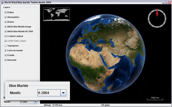
The imagery is already there for WorldWind .Net, so it is just a matter of configuring a layer for each of the twelve Blue Marble Next Generation datasets for the year 2004.

Blue Marble twelve month for WorldWind Java
Download BMNG2004Layer and BMNGTwelveMonth example application. The layer goes in worldwind.layers.Earth, and the example in ...examples.

None of the twelve layers have a 'base' image yet (except may 2004), so you will have to wait for the level zero tiles to download the first time you switch month.

A WMS version of those datasets should be available a some point.
Thursday, December 13, 2007

Full Mars And Moon Globes for WWJ

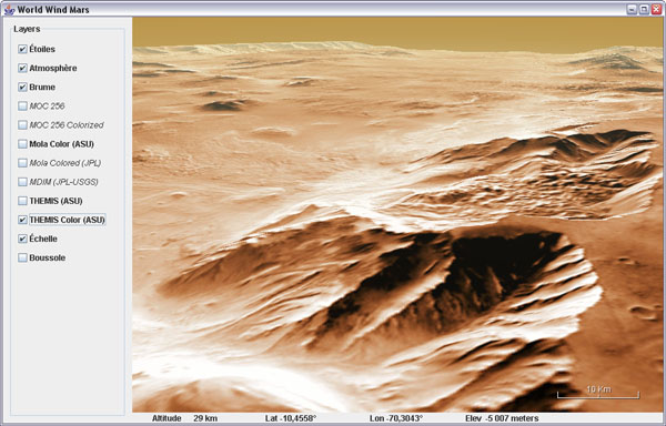
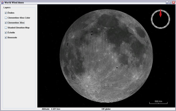
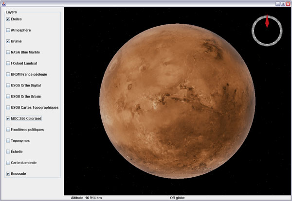
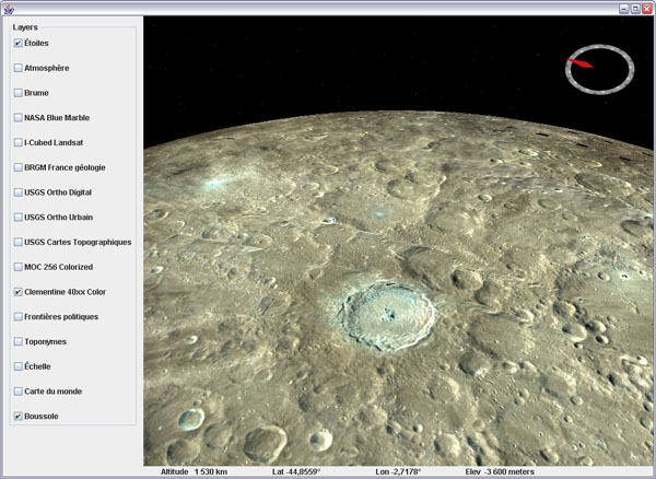
Here they are, the Moon and Mars with elevations and the full layer sets from the .Net version.

WWJ Mars THEMIS ColorMars THEMIS Color layer

WWJ Moon Clementine 30Moon Clementine 30

Download WWJ_Moon_And_Mars.zip (15k) and add to your WorldWind Java SDK source tree.

The package includes two example applications that put together the two globes with the appropriate layers.

Be patient at first run: these globes do not have a 'base' image layer that ensures you see something even with an empty cache. So the first time you will have to wait for the level zero tiles to get through before you have a planet to spin.

The elevation data comes from the same servers as the .Net version but in zipped files. This service has never been used and has an empty cache right now, so the first users will have to wait a bit longer to see some alien mountains.

Tuesday, December 11, 2007

WWJ Look Around View Example

WWJ View Look Around example
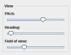
Here is a view control panel example that simulates a 'first person' view with the default orbit view.

Download the ViewLookAround.java example - remove the .txt extension and add it to the worldwind.examples package.

Although this is far from a first person view implementation that would let you walk or fly around, this simple example allows you to 'look around', as if you where suspended in the air at a fixed position.

Sunday, December 9, 2007

WWJ Layers That Shall Not Be Named

Vladimir Silva who brought us the World Wind Eclipse RCP Geobrowser just posted a new contribution on the WWJ forum. Something that many where hoping for - without saying it too loud... someone said applet?

Check this forum thread, and the reference material.

Wednesday, December 5, 2007

WorldWind Java SDK 0.4.1 offline mode fix

A bug fix release has been posted late today. Here are links to the WWJ SDK 0.4.1 (Zip 6.5M) and the Java Web Start demo 0.4.1.

From the forum post:

"Fixed NetworkStatus bug causing freeze for some, added an off-line attribute to the WorldWind class to elect not to use the network, added a show-network-status attribute to StatusBar".


And from a post related to offline mode issues:
"I've also added an off-line mode attribute to WorldWind for apps that never want to contact the net. Just invoke WorldWind.setOfflineMode(true)."

I updated my previous post about 0.4 - was it yesterday?

Tuesday, December 4, 2007

WorldWind Java SDK 0.4 is out

As previously hinted a new code update has been posted today by the WWJ team. Here are links to the WWJ SDK 0.4.1 (Zip 6.5M) and the Java Web Start demo 0.4.1.

WorldWind Java SDK 0.4.0
What has changed since 0.3 - October 10, 2007:

Annotations are the main new feature - you have already seen a couple screenshots here. I will come back to them in future posts.

As usual, many bug fixes and corrections have taken place - some in response to the forum comments and requests: the shutdown process has been revisited, the input handler now allows the application to use and consume mouse events before they get to it, layer opacity support has been improved - although it is not yet what you would expect. WMS capability parsing has been made faster too and network operations should generally behave better when offline.

Flat worlds have been moved to the main source folder so you can have a glimpse of it - however it is not yet ready for prime time as you will quickly find out.

The image tiles processing order has been revisited and will now load lower resolution levels before loading the needed one. This behavior ensures that a layer stays 'consistent' when zooming out - tiles are not missing.

New level set constructors allow to create custom tiled image layers - see BMNGLandsatCombined example.

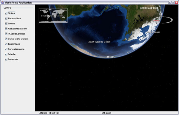
You will notice the overall WorldWind SDK package is lighter - 6.5M vs 13M. The Blue Marble level zero tiles have been removed and replaced with the BMNGOneImage 'base' layer. Worldwind.jar is now 1.6M vs 5M in the previous version.

December 5 update: version 0.4.1 has been posted in response to problems with offline operations: "fixed NetworkStatus bug causing freeze for some, added an off-line attribute to the WorldWind class to elect not to use the network, added a show-network-status attribute to StatusBar". Above links have been updated.

Check this post on the WWJ forum for details of the version readme.txt and follow up comments. Also check WorldWind Java SDK home pages at NASA Learning Technologies and WorldWind Central.

Friday, November 30, 2007

WorldWind Java Annotations Preview

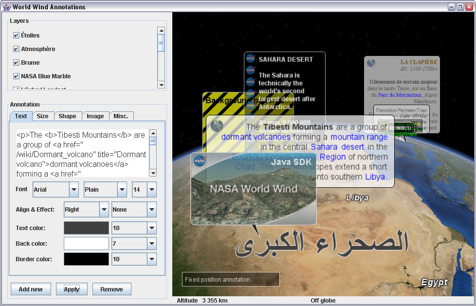
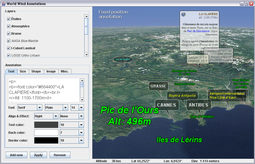
Annotations are ready to roll and will be in the next WWJ SDK update 0.3.x or 0.4 - which should be ready 'soon'... Here are a couple screenshots showing different variants from the included example application.


Annotations are essentially text labels with a lot of style attributes. They will come in two flavors: globe annotations which are associated with a position on the planet, and screen annotations which are at a fixed position in the viewport.

In the above view all you see are annotations - from the simple 'Egypt', 'Libya' or arabic for 'Sahara desert' labels to the full blown 'billboards' or 'bubbles' with textured backgrounds and moderately wealthy text.

As you can see annotations come with a multi line text renderer and 'wrapper' with minimal html support, text picking and hyperlinks. The text about the Tibesti mountains is a cut-and-paste of a paragraph straight from a Wikipedia page source.


The example application will offer you no less than 39 controls to experiment with all the annotation attributes combinations. Text font, size, style and alignment, insets 'margin', background color and texture repeat options, dimensions, scaling, opacity, offset from position... Overall it should cover quite a range of applications from simple labels to moderately sophisticated 'popup balloons'.

In any case, if the SDK basic implementation is not enough, it is very easy to subclass annotations and override the drawing process to add your own code in place or on top of it. The example does also contain several override code bits - you'll have to read the source to find them.

This is just an 'avant goût' to get you salivating a bit. I will come back on the subject for more detailed explorations of this new feature of the SDK - like shared attribute sets and cascading defaults...

Monday, November 26, 2007

Mars and Moon layers for WWJ

Someone just asked about Mars in the WorldWind Java forum and this reminded me the imagery is out there for the .Net version of WW, begging to be streamed into WWJ.


Mars MOC Colorized 256 layer


Moon Clementine 40xx color layer

Here are Mars MOCColorizedLayer.java and Moon Clementine40Layer.java - they are supposed to go in worldwind.layers.Mars and Moon respectively. December 13 update: get the two full globes here.

This of course is just a preview of the two bodies - over the Earth surface. The elevation data is out there too, but needs to be compressed differently for WWJ, and that is not ready yet, i believe. Eventually the Moon and Mars will have their own globes, elevation models and layer sets.

Saturday, November 24, 2007

WWJ Bug Exhibition

Sometime things go wrong. In most occurrence it doesn't produce anything more than irritation, but on rare occasions it can also lead to quite unexpected or intriguing results. Here are a few screenshots captured in such moments:


The 'globe back flip' made a fugitive appearance recently. New Zealand was on top of the world at last.


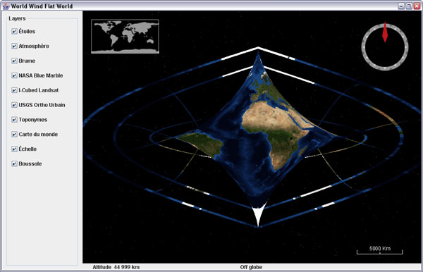
What came to be known as the Butterfly World emerged spontaneously from a wrong modification of the sinusoidal projection in flat worlds... i was expecting more of an oval shape, and there it came out. I took the screenshot and corrected the code. We will never know what was the formula. Chaos and butterflies, what a cliché.


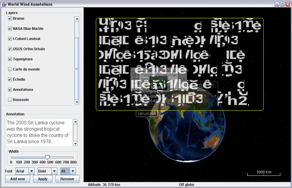
The bold garbled text bubble briefly showed up during annotations development, while challenging JOGL text renderer with lots of larger fonts. What powerful message is hidden in this unknown dialect?

I cant help but feel there is something far reaching in the symbol. At a private showing in New York, someone fainted and a guest got so agitated he had to be helped out. "The big void in the middle of the first line is very unsettling i admit" declared the embarrassed host.

Sunday, November 11, 2007

WMS Layers on iPod Touch

Almost two weeks since i got the IPT and so little time to hack into it... I still havent managed to install the iPhone applications but i got it 'jailbreaked' and have a Finder now with a couple additional icons. However it will probably not last long with the coming firmware updates...

It is quite exciting to see that the little tablet is a 400Mz OS X platform. There are already many sites dedicated to using the touch or the phone as an 'open', mobile, computing device and many applications are coming.

Blue Marble Next Generation on iPod Touch
Actually, the easiest way to make an application for these device is to use html and javascript with Mobile Safari. These are so called 'web applications'.

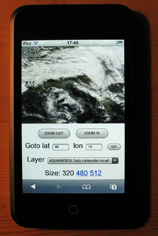
So back to Notepad and some good old school javascript, i put together a very simple mobile WMS browser (updated november 16).

This is not World Wind but at least you can browse a couple WMS layers i grabbed from the WMSLayerManager example in the WW Java SDK: Blue Marble Next Generation (june 2004), Blue Marble 'classic', Landsat7 I3, Global mosaic 15m visual, Terra/Aqua daily shots and a few others (including France BRGM geology and USGS layers).

Have a look at the source - its all contained in one page and it is very easy to add more layers. Feel free to copy, edit, reuse and abuse ;)

Tapping (or clicking) on the edges or corners of the tile will have you move sideways or in diagonal. Tapping inside the image will zoom on the corresponding latitude and longitude.

Some controls at the bottom let you zoom out, goto a specified latitude and longitude and select different layers. Still a bit crude, but usable... and you can put (and share) bookmarks anytime.

The page has to be hosted somewhere though. I wonder if it could simply be transfered in the IPT and opened locally with Mobile Safari. Probably easy to do if you know a bit OS X or Linux...