Loading WW Pathlists into WWJ
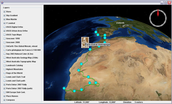
Again a first try at loading vector pathlists from WW as WWJ polylines. The screenshot shows the Paris Dakar 2007 rally path across the western Sahara desert (icons are loaded with another layer).

Download WWJ_WWXMLPathListLayer.zip (109K) and follow instructions in the readme.txt to add the included "Lewis and Clark trail" to the BasicDemo application.
This first version doesnt work very well except for short and local pathlists. It seems that SurfacePolyline in the current WWJ 0.2 release does not handle very well large or extended sets of path. Also the lines are rendered as bitmaps drapped over the terrain with a fixed line width that is either barely visible from far away or too coarse when close.
Or maybe i should use Polyline instead of SurfacePolyline...
See this WWJ forum thread for discussion.

1 comment:
Bonjour,
Je m'intéresse depuis peu à la version Java de WorldWind. Une fonctionnalité manque cruellement pour le moment: la possibilité d'afficher des couches de données vectorielles comme des Shapefiles, MIF/MID...
J'ai parcouru ton blog avec le plus grand intérêt et la gestion de tracks GPS semble être un bon début de piste à suivre.
Post a Comment